Biking
 Login
Login More
More EN
EN Premium
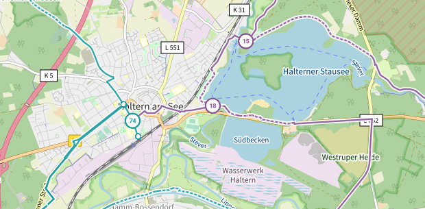
Explore Haspengouw from Hasselt
automatic translation
57.3 km • Hasselt
 official route
route offered by
 Addresse starting point (approximate)
Parking Japanse Tuin: Gouverneur Verwilghensingel 16
 signage
The route is fully signposted with nodes.

 Description
From the capital of Limburg, this route takes you towards the rolling fruit landscape of Haspengouw. Expect impressive panoramas, square farms, quiet church villages and magnificent castles. A blossom splendor in spring, but possibly even more colourful in late summer, when apples and pears are blushing in the plantation. Immerse yourself completely in the story of the fruit region with a visit to the Syrup Factory in Borgloon. Or just pick up syrup waffles for the rest of the route? Towards Diepenbeek, we gradually exchange the fruit landscape for a patchwork of bushes and meadows with relaxing dairy cattle. The final kilometers flow nicely along the Demer river towards the finish in Hasselt.
You can shorten the route at node 121 (36 km instead of 58 km).
automatic translation
 nodes to follow
0 km
2.9 km
3.8 km
4.8 km
9.6 km
11.4 km
13.3 km
16.4 km
17.4 km
24.6 km
27.5 km
28.8 km
33.6 km
34.2 km
39 km
41.1 km
43.7 km
45.8 km
47.6 km
49.8 km
51.3 km
57.3 km

 Upgrade to Premium Plus