Hiking
 Login
Login More
More EN
EN Premium
Welle and Kapellemeersen hiking trail
automatic translation
13.6 km • Denderleeuw
 official route
1361 0 0/5
13.6 km
0.0 km
0.0 km
route offered by
 Addresse starting point (approximate)
Kouterbaan 99, Denderleeuw
 signage
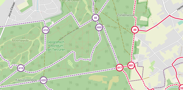
The route is fully signposted with nodes.

© Toerisme Oost-Vlaanderen
 Description
A stone's throw from Denderleeuw station, you dive into the Welle and Kapellemeersen, the last intact flood plains of the Dender. Together they belong to the best preserved natural pearls of this region. Good for a hiking trail covered in greenery!
automatic translation
 nodes to follow
0 km
1.6 km
2.6 km
4.3 km
5.8 km
6.6 km
7.7 km
10.8 km
11.7 km
11.9 km
13.5 km

 Upgrade to Premium Plus